about the kern river basin cloud seeding programThe Kern River cloud seeding program began operating in 1951. RHS Consulting began seeding this project in 2009. The Kern River watershed has an area of about 2,000 square miles upstream from Lake Isabella. From its headwaters, the 165 mile long Kern River originates from several small lakes in rugged high elevation terrain near Mt. Whitney (4419m) in the northeast corner of Sequoia National Park. The North Fork of the river flows southward through the Golden Trout Wilderness and joins the Little Kern River at the Forks of the Kern. The river continues flowing south through the Kern Canyon into Lake Isabella, where the South Fork of the Kern joins the main branch of the river. Below Isabella Dam the Kern River flows southwest down a rugged canyon that emerges just east of Bakersfield, CA. In Bakersfield, the river is diverts through a series of canals and ditches to irrigate farms and provide municipal water supplies to the City of Bakersfield and surrounding areas.
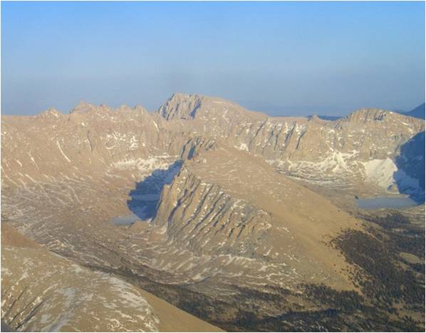
The Kern basin is a unique watershed within the Sierra Nevada range because of its north-south orientation, steep canyon walls, and extended southerly flow drainage. Most other Sierra watersheds face and drain to the southwest. This unique shape, alignment, and topography give the Kern River basin its own meteorology regime and climatology. The high elevation terrain in the northern half of the basin, near Triple Divide and the Sierra Crestline form the primary target area of the program. During periods of southwesterly flow the Sierra Crestline behaves like a leeside target because of the presence of the double barrier. This makes successful targeting subtle and more challenging than the windward single barrier watersheds located to the north. Careful consideration must be taken to select the proper seeding altitude to ensure that the seeded ice crystals created on the windward side of the Western Rim are formed at altitudes high enough that they fallout in the Kern Basin, but not so high that they never fallout in the Basin and pass over the barrier and fall downwind on the leeside of the Sierra barrier and Nevada. End-burning flares are the preferred seeding method because they produce a line source of ice nuclei that makes it easier to estimate the precipitation fallout pattern. During warm events, the seeding aircraft has the option to climb to colder temperatures and use ejectable flares. Subtle changes in seeding altitude can make the difference between seeded precipitation falling on the windward side of West Rim or falling much farther east in the upper reaches of the Sierra Crestline. One big advantage the Kern target area has over lower elevation targets located in the Northern Sierra is the extremely high terrain allows cloud water and vapor to pool and concentrate on the windward sides of the West Rim, Great Western Divide and Sierra Barrier. The high terrain provides a greater depth of subfreezing temperatures that allows larger amounts of supercooled cloud water and vapor to form just upwind of the target area. Seeding this pool of cloud water and vapor from slightly above barrier heights allows for maximum conversion and sweep out of the available condensate and vapor as precipitation. This is particularly important in the early phases of a storm when temperature profiles are warm and winds are from a southerly direction, for example, as a major band approaches the area it can be seeded from higher altitudes to initiate the precipitation process earlier in the storm sequence. |
snowpack enhancementThe purpose of the Kern River Basin Cloud Seeding Program is to augment precipitation falling in the higher elevations of the Upper Kern River Basin upstream of Lake Isabella. The program is designed to enhance water supplies for irrigation, hydroelectric generation, municipal, recreational and environmental uses. Aircraft seeding is used to target the basin largely because most of the target area is located in wilderness areas. The seeding season has been extended into the summer as water conditions require.
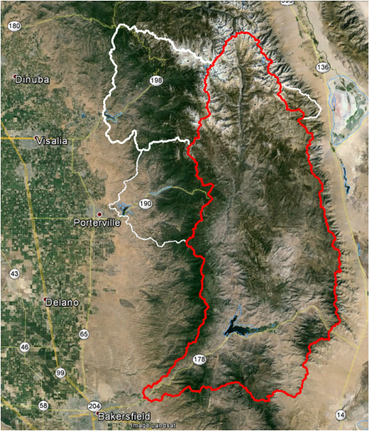
The red boundary shows the borders of the Kern River Basin target area. Outlined in white are the Kaweah River, Cottonwood Creek, and Tule River Basins. Cottonwood Creek and the Tule River Basin are used as controls for this program.
how we EVALUATEThe program is evaluated using snowpack and stream flow data. The objective of the evaluation is to: (1) determine if cloud seeding is enhancing stream flow in the Kern River Basin, (2) provide information about the spatial impacts of how seeding affects the snowpack in the target area, and (3) provide information on the strength of seeding effect to allow decisions to be made about the program’s cost-effectiveness.
|
Contact Us |
RHS Consulting, Ltd.
|
|
Copyright @ 2023 RHS Consulting |